 Loading... Please wait...
All prices are in All prices are in AUD
Categories
- Home
- Antique Maps
- Classical Geography
- Maps Classical Geography Syria Assyria Ptolomy Browne 1725 Antique Print
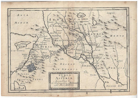
Maps Classical Geography Syria Assyria Ptolomy Browne 1725 Antique Print
Product Description
Map Classical Geography "Syria and Assyria According to a Description of Ptolomy and other Authors" Christopher Browne c.1725
Antique copper-plate engraving on laid paper with original hand colouring, for Christopher Browne's folio "The Geography of the Antients so far as describ'd as is contained in the Greek and Latin Claffics (Classics) in The Maps of the Old World and its several Kingdoms and Provinces..." printed London 1725, "A Collection long wanted, and now Publish'd for the Use of Schools"
Condition = Excellent with no grime, foxing mould, tears. Printed on Laid paper folded in middle preparing it for binding. Plate mark complete.
Size of Page= 265 x 180mm / Size of Plate mark = 162 x 232mm


