 Loading... Please wait...
All prices are in All prices are in AUD
Categories
- Home
- Antique Maps
- Antique Map SDUK Walker Spain Portugal Europe 1853
Product Description
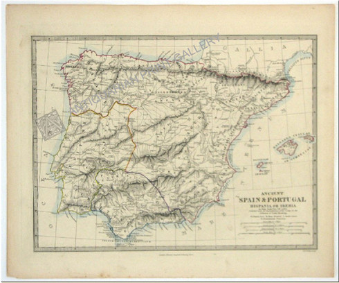
Antique Map, European, Spain, Portugal, Hispania, Iberia, J & C Walker, SDUK, 1853
Ancient Spain & Portugal Hispania or Iberia
Antique steel engraving by John & Charles Walker after cartography by Philip Smith, University College, London. Original hand coloring.
Published by Edward Stanford, 6 Charing Cross, London, "under the Superintendence of the Society for the Diffusion of Useful Knowledge", 1853 on "Wove" paper, made from flax and hemp
Condition = Very Good. Plate-mark is complete with discolorations along bottom edge and faint water stain also, well clear of the plate-mark
Paper Size = 36 x 43.2cm (14 1/3 x 17 1/4 inch) / Platemark dimensions= 31 x 40.6cm (12 1/3 x 16 1/6 inch)
Society for the Diffusion of Useful Knowledge or SDUK
In the 1820s, with the ripening of the Age of Enlightenment, that had begun in the mid-1600s, it was considered essential to provide affordable, accessible education for the working and burgeoning middle classes, who were often self-educated. Benevolent societies whose intentions were to disseminate knowledge, were a distinguishing feature of the Post Georgian/early Victorian age. The SDUK was founded in 1827 by John, Earl Russell and Henry Brougham, later Lord Chancellor of England. Earl Russell was an M.P. who was responsible for setting up an inspectorate for schools. and he secured an additional grant of 30,000 pds for education. There was no compromise with the quality of source material or production. Indeed, the maps are accurate in detail, finely engraved by respected engravers of the day and printed on a high quality "wove" paper.
John & Charles Walker
John and Charles Walker were cartographers and draughtsmen, sons of the highly revered engraver John Walker. They were London Print-makers who worked at 47 Bernard St off Russel Square 1830-1836, at which time John Junior was appointed Hydrographer to the East India Company. Moving to No 3 Burleigh Street off the Strand and in 1840 to Castle Street, Holbourn until 1847. Their final address was No. 7 Castle Street in Holbourn until 1875. They are best known for their comprehensive British County Survey consisting of 47 maps between c.1835-1842. J & C Walker worked with the S.D.U.K.for whom they engraved maps. They also worked collectively for the Admiralty as map engravers. Priding themselves on accuracy, this was a challenging task due to the emergence of railway companies and their contemporary impact on the landscape. These bickering and warring railway consortiums often altered railroad destinations while the ambitious maps were being engraved.


