 Loading... Please wait...
All prices are in All prices are in NZD
Categories
- Home
- Giclee Prints
- Maps and Charts
- Adelaide CBD by W.G. Fuller c.1910
- Home
- Giclee Prints
- South Australian Scenes
- Adelaide CBD by W.G. Fuller c.1910
- Home
- Giclee Prints
- Maps and Charts
- Australia-Asia-Pacific
- Adelaide CBD by W.G. Fuller c.1910
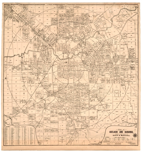
Adelaide CBD by W.G. Fuller c.1910
Product Description
Street Map of Adelaide City Business District (CBD) circa 1910
Adelaide and Suburbs Credited to Date expressly for Sands & McDougall (by) W.G.Fuller, Architect & Surveyor, Semaphore.
Archival Limited Edition Giclee Print of a map compiled by W.G Fuller in approximately 1912 as research into street name changes and recognized suburbs indicate. Such names as Cottonville, Knoxville, Grassmere, Bismark and Hayhurst were among the many that were amalgamated or renamed as the city expanded. Notably Bismark did not survive the national trend to rename all references to our German colonial immigrants.
Size of image 91cm width x 97cm height


